
Concrete Covered Reservoir
Leaflet Map at Fukushima Daiichi
Oh, on that covered site – I confused the location …. it is farther up the road past the cattle ranch – about 12 kilometers or maybe more – with the edge of the Fukushima Nuke (smokestack only as it is lower in elevation by the seashore). Have not found yet a good detailed road map.
OK, Map Carta is crappy but most other maps of Fukushima are partially blocked or edited heavily on anything to do with the Meltdowns.
The Key Roads after the meltdown were the Coastal Highway and further inland Roadway/Highway 6 south-southwest of the Tepco plant. However, after the meltdown 24-hour police guard checkpoints banned entry by any vehicles other than Tepco service workers and government types.
Leaflet Map (Highways) at Fukushima Daiichi
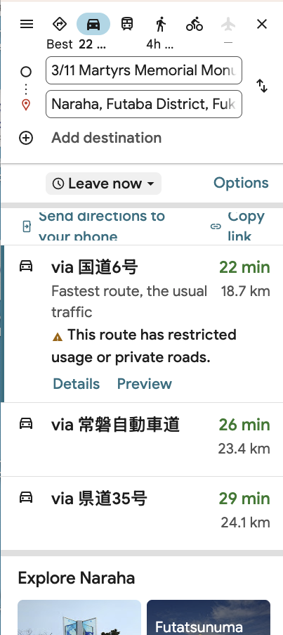
Link to above GMap with Directions
Gmap with Directions
The checkpoint was about a mile past Route 250 (the path to the Kido Dam). So the junction of 250 inland and 6 north served as the (illegal) “gateway” to the various “forbidden zones”. To proceed north toward the wrecked reactors which were however below the steep hills/cliffs was on 6 north, where I gained by bicycle a close-up view of the abandoned farms and high radiation readings with the dosimeter.
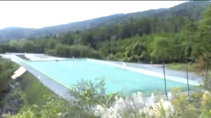
It was about 2 miles (north) on highway 6 that I spotted the “Fake Lake” of blue tarps covering the area of a football field (probably a former rice paddy aka without trees and bushes) for a photo of which I rode to a pedestrian crosswalk on the northside. That’s when the guard spotted me and contacted the police, forcing my hike with bike uphill southward to the abandoned cabins of summertime tourists, where I sat for several hours before resuming on the path northward toward the nuclear plant.
About a month later the French journalist flew to Tokyo from Thailand (where I first met him in Bangkok while he was still married to a black female songstress from L.A.). She came along for the adventure and after seeing how absolutely dangerous was our profession (the radioactivity along the ground burned the soles of her feet — which us guys took in stride (joke but not a joke) – she divorced him and returned to the comfort of nightclubs in the USA.
Since the rental car was banned from crossing roadblocks, I had him – Phillippe Carillo, a former French Foreign Legion trooper in Africa – circle around along the main national Highway 1 inland and circle around to reach Sendai and northern Fukushima to access that nuclear port destroyed by the Tsunami.
The port site is on the current map of Japan (it seems the town name of Haramachi has been scrubbed since) …. and the black bands cover the site of the secret nuclear warhead lab that was right by the seawall of the port (the latter expanded by new port facilities probably serving as a retaining barrier to lessen rad leakage.
BETTER Shots
Due to the obvious requirement to expose the facts about the actual extent of damage and contamination, my more personally favorite (subjective) scenes were missing from the video program.
These included:
1. a small harbor packed with fishing craft fully and defiantly decorated with traditional flags and banners but with nobody around expect our 3-person team.
2. shots of dump trucks without proper tarp covers on the roadways blowing off radioactive dirt particles onto school children walking home from school in the late afternoon.
3. distant shots of Rectangular Fog that looked like boxcars on the sea – clouds of Tritium – which scared the crap out of the local seaside population as a bad omen (within 2 years the seaside region’s population had been decimated as I discovered going door-to-door knocking on wood and shouting.
4. Nuclear clean-up workers – poor fellows imported from Hokkaido and Okinama on the edges of Japan proper – getting off work at the clean-up site, taking off their shirts and moaning like prisoners doomed to die … on the way to the shower room.
5. Evening falling over the Abukuma River toward my grandfather’s home town, which was totally wiped out.
dangerousroads website for Route 6